What to See and Do in Alájar (Sierra de Aracena): Peña de Arias Montano, Walks & Local Tips
What to See and Do in Alájar (Sierra de Aracena): Peña de Arias Montano, Walks & Local Tips
A practical guide to visiting Alájar near Aracena: what makes the village distinctive, what to see at Peña de Arias Montano, easy walks, food ideas, parking advice, and half-day or full-day itineraries.
Alájar lives beneath an extraordinary piece of rock. The Peña de Arias Montano rises so abruptly behind the village that it slips into almost every view while walking the streets below.
It is easy to reach from Aracena, around twenty minutes by car, but the short journey brings you somewhere with a character entirely its own. White houses climb the hillside until the streets give way to woodland. Above them, the limestone bears the marks of water moving through it over thousands of years.
Come for half a day and you can wander through the village before driving up to the sanctuary. With a full day, you can walk to the Peña and continue along an old path towards Los Madroñeros. Come back hungry and make lunch the final destination. This guide will help you decide what to do in Alajar and make the most of this beautiful Sierra village.
Alájar at a glance
- Location: Sierra de Aracena y Picos de Aroche (Huelva province), a short 12km drive from Aracena
- How long to visit: Half day is satisfying; a full day lets you add a walk; overnight is ideal if you want quiet evenings and stargazing
- Best for: Views, slow wandering, gentle village life, easy nature walks
- Main sights: Peña de Arias Montano, Ermita de Nuestra Señora de los Ángeles, village centre and plazas, Iglesia de San Marcos / San Bartolomé (church), countryside paths
- Parking: Usually simplest around the village edges and near the Peña (availability varies by season and events)
- Best time to go: Spring and autumn for walking + clear light; summer for cooler evenings; early September if you’re interested in local pilgrimage traditions (but always recheck dates)
- Important dates: El Poleo on 7 September and the Romería de la Reina de los Ángeles on 8 September
Begin in the Village
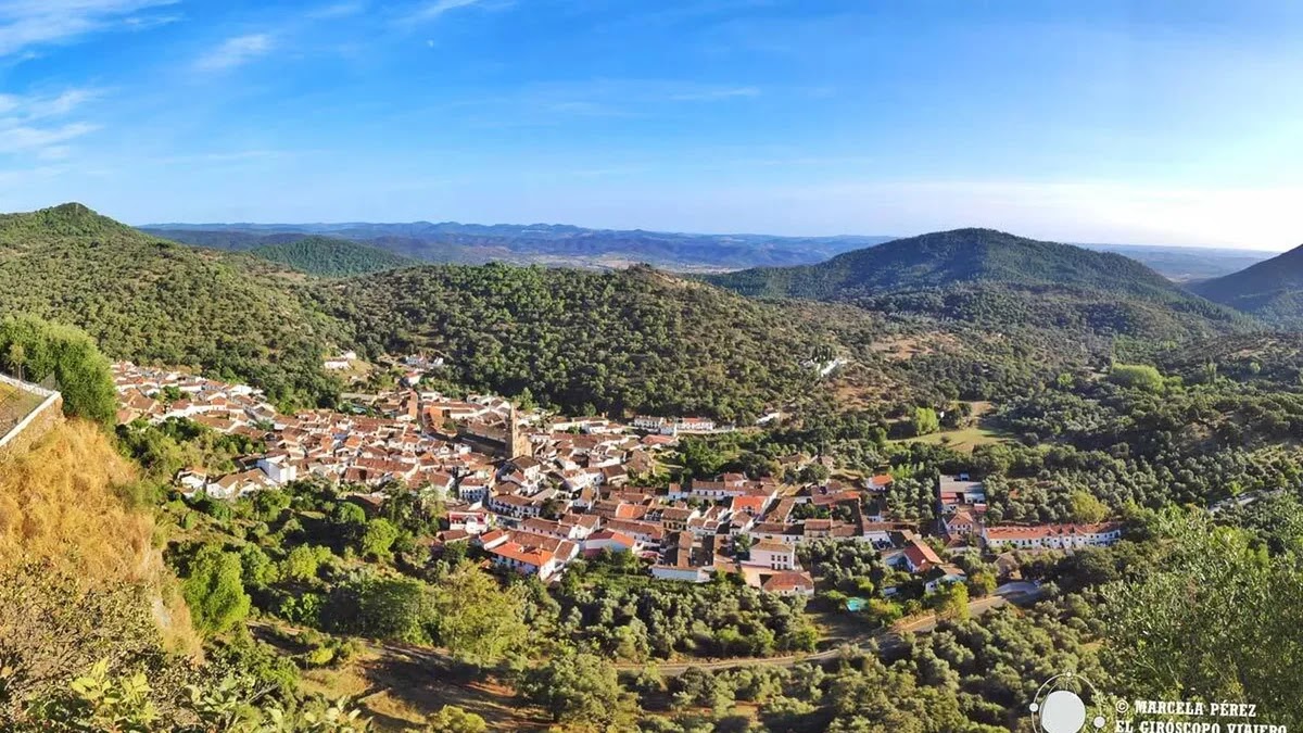
Alájar is small enough to explore without a planned route. Park on the outskirts of town; the narrow residential streets are far more enjoyable when you are not negotiating them from behind a steering wheel. The village is small enough to continue to the centre by foot. It follows the hillside in white façades and terracotta roofs, interrupted by iron balconies, enormous wooden doors, and sections of stone that have outlasted generations of residents.
Alájar’s historic centre is protected as a Conjunto Histórico-Artístico, a Spanish heritage designation recognising the architectural and cultural value of the village as a whole. Nobody, however, has polished away the signs of ordinary life. Laundry hangs above the street, flowerpots and café tables still have to share the streets with delivery vans, and neighbours stop to chat. Give yourself time to wander and get familiar with the heart of the town.
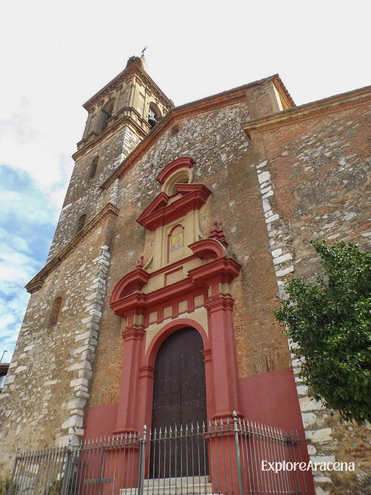
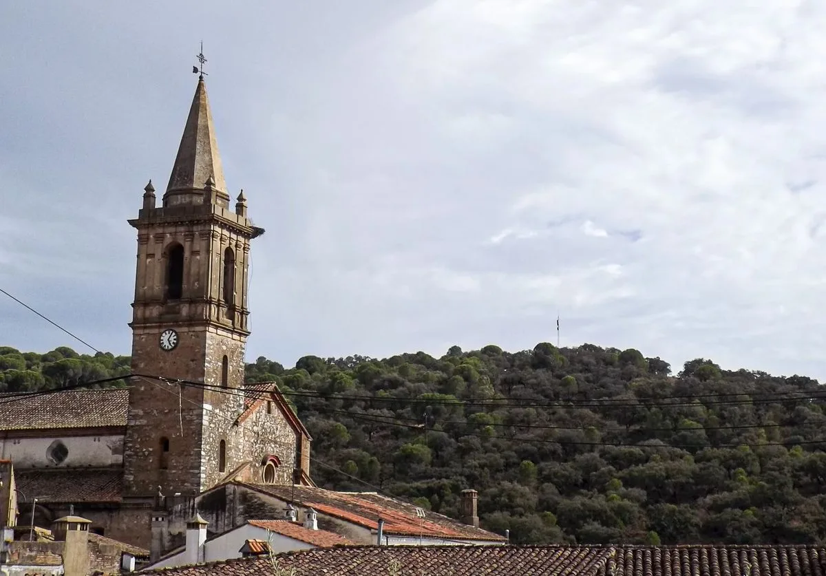
Iglesia de San Marcos is the main church in the village. Its tower rises clearly above the surrounding roofs and makes a useful point of reference as you walk. Opening hours may vary, but the church and the square around it are worth finding even when the doors are closed.
We suggest pausing for coffee or a drink before heading uphill. Alájar changes noticeably during the day: quiet streets in the morning give way to busy lunch tables, while the Peña catches the last light above the village towards evening.
What to Notice as You Walk
- Look back whenever the street rises; the Peña appears differently between the rooftops
- Expect cobbles, slopes and uneven paving rather than a completely level village circuit
- Keep the car outside the tightest streets and explore the centre on foot
Visit the Peña de Arias Montano
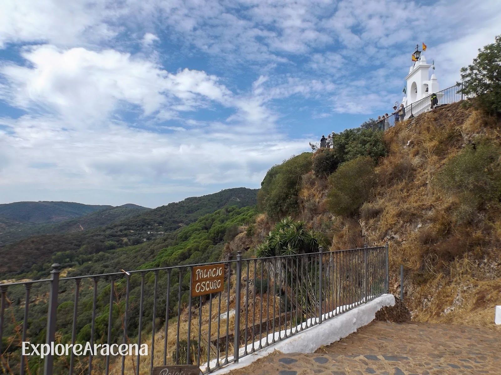
The Peña de Arias Montano is the reason many people first come to Alájar. The rocky plateau rises above the village and opens onto one of the broadest views in this part of the Sierra. On a clear day, the land appears endless in its unfolding beyond the cork oaks, chestnut groves, and distant ridges.
It has also been a place of pilgrimage and religious importance for centuries. The Santuario de Nuestra Señora de los Ángeles houses the image honoured during the great September romería. Outside the busiest celebrations, the plateau can feel spacious and contemplative, with visitors moving between the sanctuary, viewpoint and shade beneath the trees.
The Peña takes its name from Benito Arias Montano, the sixteenth-century humanist, theologian, and adviser to Philip II, who spent time here in retreat. His association adds another layer to a place already shaped by springs, caves, and centuries of devotion. Local accounts and legends have long given the rock an air of mystery, although you do not need the mythology to understand its appeal. Stand at the edge and look down towards Alájar; the landscape doesn’t need words to engage in a meaningful moment with its admirers.
The photo opportunities here are wonderful, but after taking a few epic shots, we recommend putting down your phone or camera and giving yourselves some time to unplug. Walk around the sanctuary complex, notice how the buildings rise directly from the rock and listen for water around the plateau.
The Caves Beneath the Peña
Beneath the plateau, water has slowly dissolved the limestone and opened cavities inside it. The Gruta de las Maravillas in Aracena was formed through the same natural process. The two belong to separate cave systems, with no known underground connection between them.
More than thirty cavities have been recorded around the Peña. Some have names connected to local history and folklore, including the Palacio Oscuro. In March 2026, guided visits began through Cuevas de Alájar, allowing visitors to see part of the underground landscape for themselves.
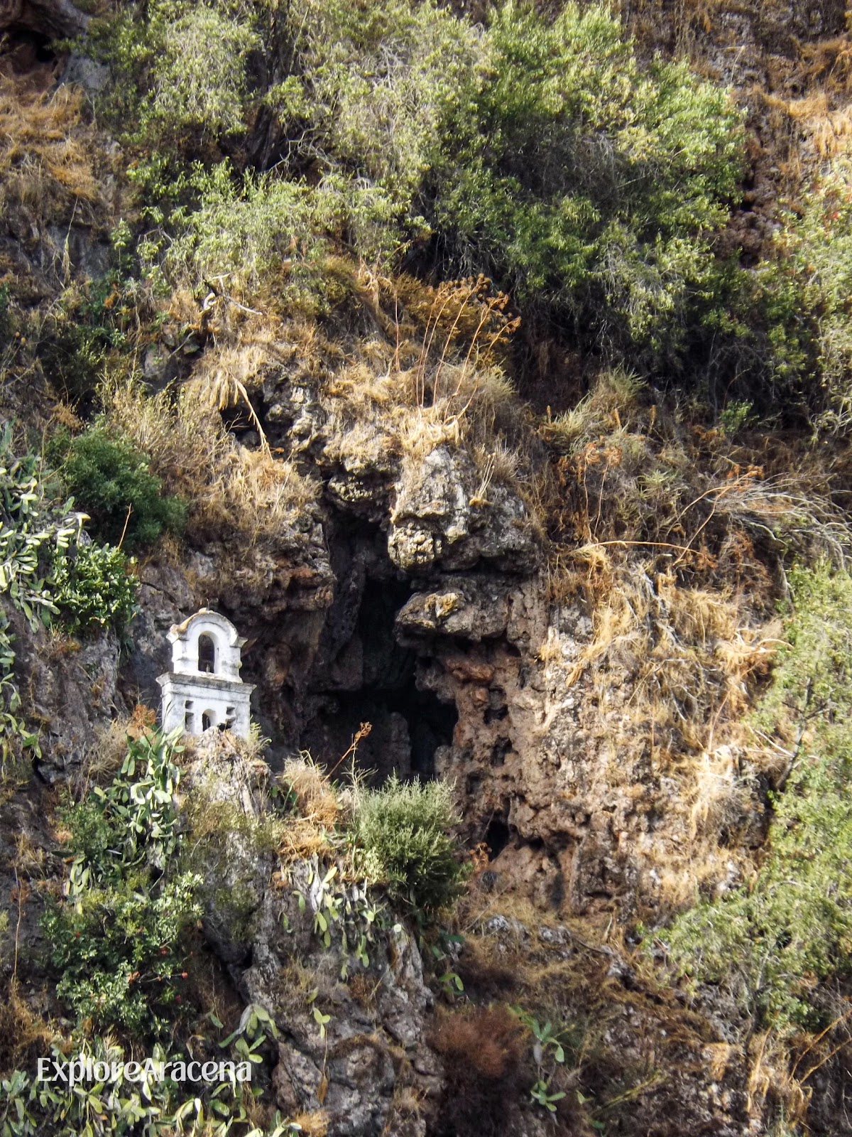
Some of the water eventually returns to the surface through the Peña’s springs. As it emerges, calcium carbonate is deposited around the channels and nearby vegetation. These layers accumulate into travertine, a pale, porous form of limestone that continues to change as water passes over it. The official Andalucía tourism feature on Alájar’s travertine landscape explains the process in more detail.
Guided visits to part of this underground landscape began in March 2026 through Cuevas de Alájar. Check current tours with the Peña and Cuevas de Alájar visitor centre before travelling. Access is controlled, and cave openings around the Peña should never be entered independently.
We will explore the caves and underground water systems found across the wider Sierra in a separate guide.
Driving or Walking to the Peña
You can drive from Alájar to the parking area near the sanctuary. The road climbs quickly and has bends, so take it slowly and watch for walkers and cyclists.
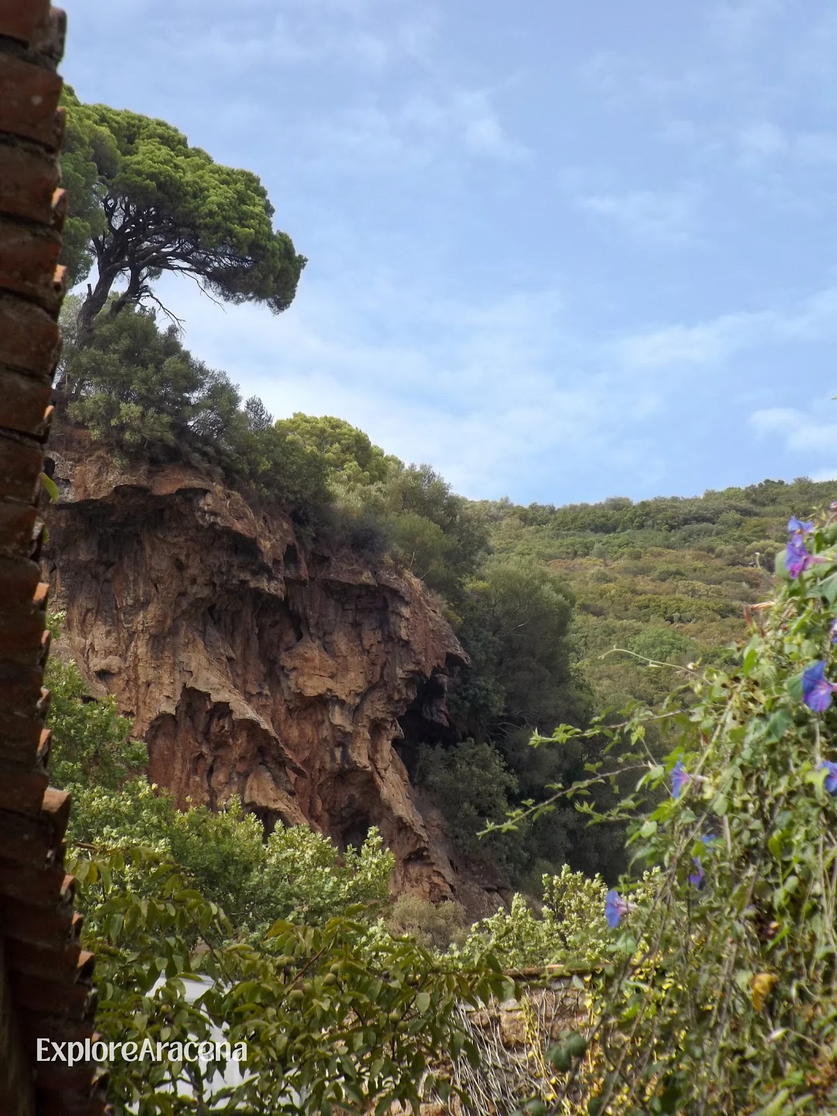
We recommend walking if you are comfortable with a steep ascent. The Peña is strikingly above you at the beginning of the journey, appearing between rooftops as you cross the village. During the hike, that perspective reverses. Alájar recedes into a cluster of white houses, and the rock you have been looking up at becomes the ground beneath your feet.
The climb is steep in places, so wear shoes with good grip and carry water. In summer, leave early in the morning or wait until the strongest heat has passed. Navigation apps can suggest unsuitable shortcuts, so confirm the current walking route locally before setting out.
Bring a light layer if you plan to stay for sunset. Wind moves freely across the plateau, and the temperature can drop surprisingly quickly while the village below is still holding the warmth of the day.
Walk from Alájar to Los Madroñeros
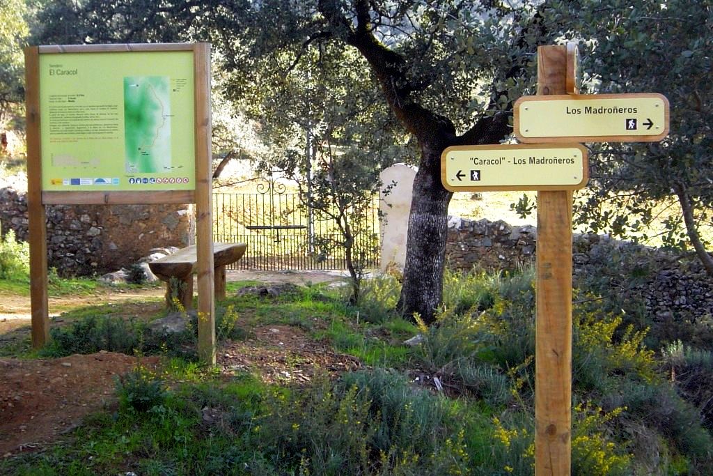
The old path from Alájar to Los Madroñeros takes you beyond the village streets and into the working countryside of the Sierra. It begins in El Nogalejo, southeast of the centre, before climbing between dry-stone walls towards the Puerto de los Madroñeros.
The official Junta de Andalucía route is linear rather than circular. It covers approximately 1.7 kilometres in each direction and takes around forty minutes one way. The return brings the complete walk to roughly 3.4 kilometres. Allow between ninety minutes and two hours if you intend to explore the hamlet or stop along the path.
Download the official route sheet and map before leaving.
The path passes through several different faces of the Sierra. Holm and cork oaks cast deep patches of shade across the stone, while the lower ground becomes greener beside the streams.Oleanders and hawthorn grow beside the water, with rushes and ferns filling the dampest patches. Foxgloves bring flashes of colour in season. You may hear hoopoes or blackbirds among the trees, and ibérico pigs sometimes graze in the surrounding dehesa. There are places where the trees part and Alájar appears behind you, white against the hillside with the Peña rising above it. These are the views that naturally get you to stop in your tracks. Listen to that gut instinct and take the photograph, but also give yourself a few minutes after putting the camera away.
Families can make a simple nature checklist before setting out. Look for the peeled bark of a cork oak or count how many birds you hear before spotting one. Animal tracks may appear in softer ground. Children can photograph or sketch their discoveries, leaving plants and mushrooms where they grow. If you are walking with friends or as a couple, bring something small to eat and save it for the hamlet or one of the stopping places along the route.
The official trail is classed as low difficulty, although the opening ascent is noticeable and shade is limited in places. Wear shoes with reliable grip and carry your own water. After rain, the stones may be slick and the stream fuller than usual.
Download the map before leaving; mobile coverage cannot be guaranteed between the hills. Remain on the marked route and close any livestock gates behind you. Dogs should stay under control wherever animals are grazing.
Our Sierra de Aracena hiking guide covers the broader practicalities of walking in the natural park. You can also browse our activities and experiences if you want to spend more of your visit outdoors.
Where (and what) to eat in and around Alájar
Eating in the Sierra is often about simple, hearty cooking and long lunches. In a small village like Alájar, the best approach is to keep your expectations flexible:
- Plan around opening patterns. Rural places can be seasonal, and kitchen hours may be narrower than you’re used to.
- Go for local staples. In this region you’ll often see jamón, grilled meats, stews, and seasonal dishes depending on the time of year (mushrooms and chestnuts are the obvious autumn markers).
- Use Aracena for the biggest range. If restaurants are a priority, it’s smart to base your main meals in Aracena, where you have more choice, then treat Alájar as a coffee / drink / light bite stop unless you’ve checked a specific place in advance.
Lunch can easily become the centre of a full day here. Restaurants are few enough that opening days matter, especially outside busy periods. Call ahead if a particular table is important to you and reserve during event weekends.
Mesón El Padrino is located on Plaza Miguel Moya and serves Sierra cooking in the village centre. La Plazita is a flamenco tavern and offers another central option to check out. Confirm current menus, opening hours, and reservations directly.
Eating in Alájar is another great way to connect deeper with the village you have come to enjoy. Stay for the meal if you can. There is no need to drive back to Aracena simply because it has a longer list of restaurants.
If you prefer to eat after returning to your base, our guide to restaurants in Aracena gives you a wider range of choices. Even then, do not hurry lunch into the gap between two attractions. In Andalucía, enjoying a meal together over a shared table is part of the day.
Alájar’s Romerías and Village Traditions
The Peña changes completely during the Romería de la Reina de los Ángeles. The open plateau fills with pilgrims from across the Sierra, and floral arches frame the sanctuary beneath the cliff. Horses wait among the trees as each hermandad, or religious brotherhood, arrives with its banner.
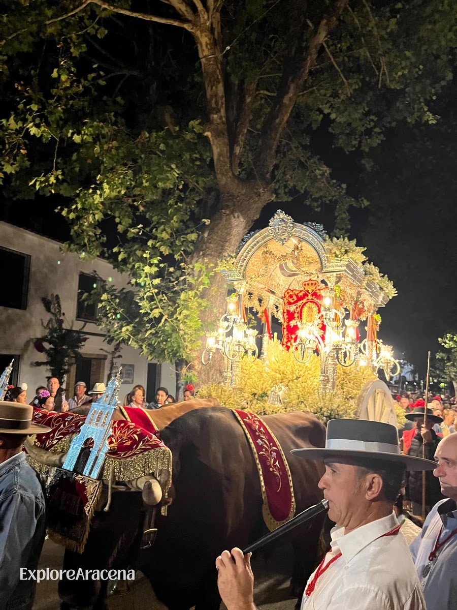
The Reina de los Ángeles is honoured as the patron of the Sierra, so this reaches far beyond a single village celebration. Nine affiliated hermandades are traditionally received by the host brotherhood on the morning of September 8th. Some have travelled from nearby villages; others come from Aracena, Nerva or Seville. When the Virgin is carried towards the wall and the crowd begins singing the Salve, attention gathers around her all at once.
The principal celebrations take place from September 6-8:
- September 6th: The festivities begin in Alájar with activities in the village. The traditional huevá brings people together over dishes made with eggs, with funds raised for a local association or brotherhood.
- September 7th – El Poleo: Riders leave Alájar for the Peña at around 11:00. The tradition began as an equestrian journey carrying local authorities (including the mayor, parish priest and Hermano Mayor) to the sanctuary. An offering is made to the Virgin after they arrive.
- September 8th – Romería de la Reina de los Ángeles: The host brotherhood leaves Alájar in the morning and meets the visiting hermandades along the route. Once everyone has gathered at the Peña, the Virgin is carried in procession.
Our complete guide to romerías in the Sierra de Aracena explains the banners, decorated carretas and customs you will encounter. We attended the Reina de los Ángeles ourselves, so the guide also shares what the day felt like from a visitor’s perspective. You can find the celebration within our wider guide to September in Aracena.
If your visit falls on these dates, prepare for a very different day at the Peña. Access roads and parking arrangements may change, and thousands of people can gather around the sanctuary. Consult the current programme from Alájar Town Council before travelling. Once there, follow the movement of the crowd and leave plenty of room around horses.
The Romería de San Bartolomé
August brings another pilgrimage with a character of its own. The Romería de San Bartolomé is celebrated around 24 August, usually during the penultimate weekend of the month. Its destination is the saint’s rural ermita at Los Llanos de Orullos, approximately seven kilometres from Alájar.
The outward journey occupies much of Saturday, with customary pauses along the route and a long lunch at Las Cruzá. The image is carried in procession around the gathering ground on Sunday before the return to Alájar begins later that afternoon.
This is a separate tradition from the September pilgrimage to the Peña. If your trip falls in late summer, the locally written Posada San Marcos guide to Alájar’s romerías offers another perspective on how these celebrations belong to village life.
Getting to Alájar from Aracena
Driving is the simplest option. Alájar is approximately 12 kilometres from Aracena, and the journey usually takes around twenty minutes. The road is scenic but winding in places. Allow cyclists room and expect agricultural vehicles or animals on rural stretches.
From Seville, Alájar is roughly 100 kilometres away. Allow around 90 minutes by car, depending on traffic and where you begin in the city. This makes the village possible as a day trip, although staying in Aracena gives you more time to explore the Sierra without repeating the full journey.
The distance from Huelva is also approximately 100 kilometres, with a typical driving time of around 80 to 90 minutes. The landscape changes considerably along the way, leaving the flatter ground around the provincial capital behind as the road moves into the wooded hills of the Sierra.
Public transport reaches the area, but services are limited and may not suit a spontaneous day trip. Some Damas buses connect Seville with Alájar or nearby Sierra villages, while journeys from Huelva may require a connection or an onward taxi. Check the current timetable carefully, including the return journey, before making plans.
If you are staying in Aracena without a car, arrange a taxi in advance and agree on the return rather than assuming one will be waiting in Alájar. Our guides to getting to Aracena and visiting without a car explain the realistic options for reaching the Sierra and travelling between its villages.
Parking
Parking in small villages is always a “real life” situation rather than a perfect system:
- Village parking: use a legal space around the edge of the historic centre and continue on foot. Do not follow navigation instructions blindly into narrow residential streets, and never block a vado permanente
- Peña parking: The Peña has its own nearby parking area. It can fill during summer weekends, pilgrimages and other celebrations. Check event-day restrictions before driving up; during the Romería, ordinary access arrangements do not apply.
Half-Day and Full-Day Itineraries
Half Day: Alájar and the Peña
Allow around three to four hours if you want to see the village and sanctuary without adding a longer country walk.
- Leave the car near the edge of Alájar. Walk into the centre and follow whichever street catches your attention. The Peña will keep appearing above the rooftops, so getting completely lost is unlikely.
- Find the Iglesia de San Marcos. Continue through the surrounding streets and stop for coffee if a table appeals to you.
- Make your way to the Peña de Arias Montano. Drive to the sanctuary or walk up if you have the time and suitable shoes.
- Explore the plateau. Visit the sanctuary area and look across the Sierra from the viewpoint. Ask about a guided cave visit if the timings coincide with your day.
- Return to the village for lunch. Book ahead if you have chosen a particular restaurant, especially at weekends.
Full Day: Countryside, Lunch and the Peña
A full day gives you time to walk beyond Alájar and still enjoy the village without repeatedly checking the hour.
- Begin with the Los Madroñeros trail. Morning is the best time for the climb, particularly during warmer months. Allow up to two hours for the return journey and pauses along the way.
- Come back to Alájar for lunch. Reserve a table in the village and give yourself time to recover from the walk.
- Spend the afternoon in the historic centre. Visit San Marcos if it is open or settle somewhere for coffee before continuing uphill.
- Finish at the Peña. The later light reaches across the surrounding hills, and the plateau often feels more spacious once the busiest visiting hours have passed. Bring a layer if you intend to remain until sunset.
Should You Stay Overnight?
An overnight stay lets you begin walking before the day warms and return to Alájar after the last visitors have driven away. It also introduces you to another side of the Sierra. The natural park lies within the Sierra Morena Starlight Reserve, an extensive protected area recognised for the quality of its night skies. On a clear evening, look up before going inside.
Alájar FAQs
Is Alájar Worth Visiting from Aracena?
Yes. It is close enough to fit comfortably into your stay while offering a village, landscape, and history that feel different from Aracena. The Peña alone justifies the drive, but the day is better when you also make time for the streets below it. If this is your first Sierra trip, our complete guide to visiting Aracena will help you decide where Alájar fits.
Can You Visit Alájar Without a Car?
It is possible, but it requires planning. Bus connections are limited, particularly for a day trip involving both the village and Peña. A pre-arranged taxi from Aracena is usually more practical.
Is Alájar Suitable for Children?
The village and Peña can work well for families, although the viewpoint, rocky ground, and roads require supervision. Choose a walk according to the children’s experience rather than distance alone, and carry more water than you expect to need.
When Is the Best Time to Visit?
Spring brings green countryside and wildflowers. Autumn is particularly good for walking once temperatures fall, although rain can leave paths muddy. In summer, visit early or late and reserve the middle of the day for lunch. September brings the great pilgrimage, but it also changes access and crowds completely.
Should You Add Alájar to Your Aracena Trip?
Yes, especially when you want to see how quickly the Sierra changes beyond its main town. Twenty minutes after leaving Aracena, you can be walking beneath whitewashed balconies with the Peña filling the space above the rooftops.
Do not reduce the visit to the viewpoint. Walk through the village first, hear the bells from San Marcos if the timing is kind, and look up whenever the rock appears between the houses. Then take the road towards the sanctuary and see the same streets from above.
Alájar stays with you in that final view: a small white village held beneath an enormous sky.