Sierra de Aracena Hiking Trails Guide – The Best Routes in Southern Spain
Sierra de Aracena Hiking Trails Guide – The Best Routes in Southern Spain
A comprehensive guide to hiking in the Sierra de Aracena Natural Park. Explore the best trails, difficulty levels, scenic white villages, seasonal advice, and why this region is one of Andalusia’s most rewarding walking destinations.
Quick Facts Before You Hike
Detail | Information |
|---|---|
Location | Sierra de Aracena and Picos de Aroche Natural Park |
Region | Huelva Province, Western Andalusia |
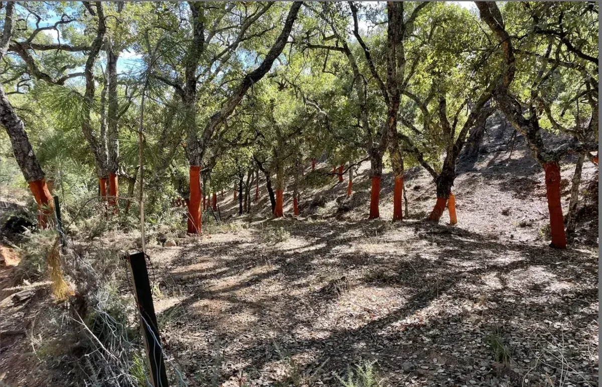
Terrain | Rolling hills, chestnut forests, cork oak woodland, limestone ridges |
Trail Type | Marked local trails (PR), longer routes (SL), village connections |
Best Seasons | Spring and autumn |
Summer Conditions | Hot mid-day; early morning recommended |
Accessibility | Moderate overall; some steep terrain |
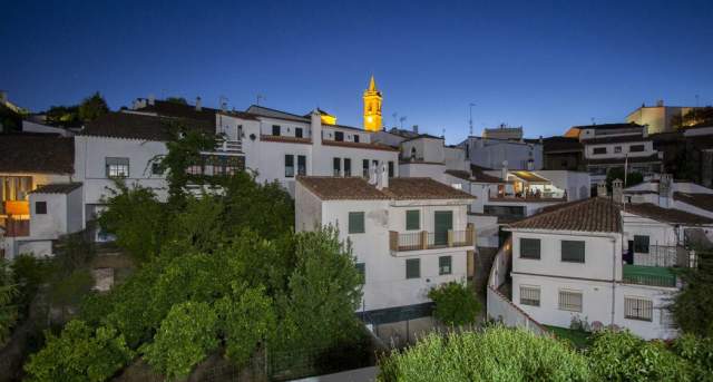
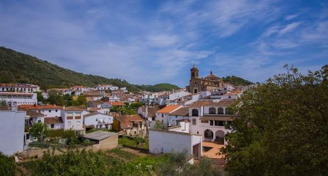
Ideal Base | Aracena |
Why Hike in the Sierra de Aracena?
The Sierra de Aracena is one of Andalusia’s least crowded and most authentic hiking regions, with some of the most rewarding hiking trails in southern Spain. Unlike the dramatic alpine landscapes of the Pyrenees or the arid intensity of Cabo de Gata, this landscape is soft and rural. The pastoral setting stays green for much of the year and feels lived in, not curated.
The first time I walked here, I wasn’t struck by a single viewpoint or moment, but the natural continuity of it all: stone walls dividing pastures, Iberian pigs roaming slowly beneath cork oaks, and whitewashed villages appearing without warning between folds of forest and ridge. The Sierra and all it holds simply exists, and it is in that simplicity that it becomes memorable.
For international travellers exploring southern Spain, hiking in the Sierra de Aracena offers something increasingly rare: a landscape where nature and daily life are still closely tied. Trails don’t feel separate from the region; rather, they lead into it.
For more experienced hikers, there is subtle depth here. Routes extend beyond short loops into longer village-to-village walks, where the rhythm of the day becomes as important as the distance covered.
Best Sierra de Aracena Hiking Trails (Detailed Guide)
Below are five of the most rewarding and accessible Sierra de Aracena hiking trails, each offering a different way to experience the landscape, but all share the same unhurried character.
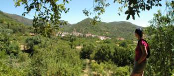
1. Aracena to Linares de la Sierra
Distance: 9 km round trip
Difficulty: Moderate
Time: 2.5–3 hours
This is one of the most classic Sierra de Aracena hiking trails. The route connects Aracena with Linares de la Sierra through shaded woodland and gently shifting terrain.
I remember the descent out of Aracena feeling almost deceptively easy, the path soft in places, before the return climb made itself known. The rhythm of the route reveals itself slowly.
Linares arrives without expectation. Its cobbled streets, patterned with small decorative stones, feel considered without being staged, situated within the surrounding nature as if it were part of it and removed from modernity.
It is ideal for:
First-time visitors
Walkers who want a village reward at the end
Spring and autumn hiking
This is a route that works particularly well if you want a sense of movement without pressure. A walk that leads somewhere, but doesn’t rush you there.
You can preview this route in more detail on AllTrails before setting out.
2. Circular Route: Alájar and Peña de Arias Montano


Distance: 7–10 km depending on variation
Difficulty: Moderate
Time: 3 hours
Starting in Alájar, this route climbs gradually toward the Peña de Arias Montano.
The ascent builds steadily rather than demanding. Even so, I found myself pausing more as the elevation increased, not from increased effort, but to take in the subtle beauty in how the landscape began to open. If you love hiking like I do, then you know how important it is to carve out intentional moments along the way to truly take in your surroundings.
Near the top, the terrain shifts underfoot. Rock replaces soil, and the horizon stretches further than expected.
The viewpoint itself is expansive. In the late afternoon, the light lands across the hills in a way that makes the entire landscape feel layered and still.
Expect:
Steeper uphill sections
Rocky surfaces near the summit
Excellent sunset light
3. Fuenteheridos to Galaroza
Distance: 8 km
Difficulty: Easy to moderate
Time: 2–2.5 hours
This is one of the gentler hiking routes in the Sierra de Aracena, connecting Fuenteheridos and Galaroza.
The terrain softens here, evoking a pastoral image. Chestnut groves create long shaded stretches, and small agricultural plots sit alongside the path.
On this route, I noticed less the distance and more the details. The shift in light through the trees that dazzles and sparkles; the sound of water moving somewhere out of sight, soothing any loud thoughts. There is a peaceful impact of the slow approach into Galaroza.
Ideal for:
Slower walkers
Families with older children
Autumn hiking when chestnut trees turn golden
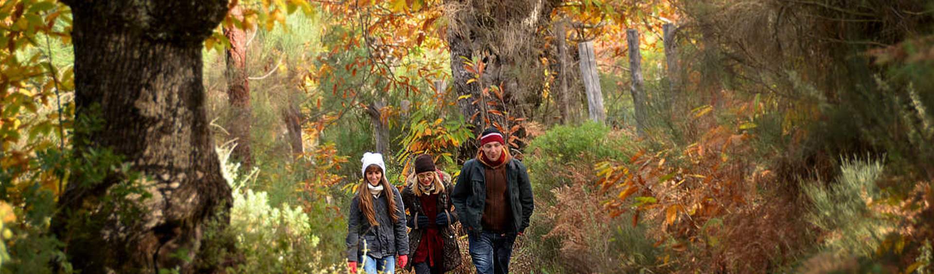
In autumn, when the chestnut leaves turn, the entire walk takes on a warmer tone. It becomes less about reaching the end and more about staying present along the way, a return to the self.
4. Castaño del Robledo Loop

Distance: 5–7 km
Difficulty: Easy
Time: 1.5–2 hours
Castaño del Robledo sits at a slightly higher elevation, and the views reflect that. The landscape opens more easily, offering wider perspectives across the surrounding valleys.
This is a shorter route, but still quite satisfying if you’re seeking peace. I walked it on a quiet afternoon and was a little surprised, yet comforted, by how little interruption there was. There was no sense of urgency, and no crowding, only the freedom and space to explore.
The simple joy that occurs when we have a moment to take in the beauty of our surroundings, and breathe in fresh air without rush.
It works well when you want to step out without committing to a full day.
5. Longer Route: Aracena to Cortegana (Experienced Walkers)
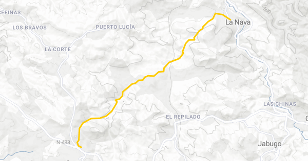
Distance: 18–20 km
Difficulty: Challenging
Time: 5–6 hours
For those looking for a full day of hiking in the Sierra de Aracena, the route between Aracena and Cortegana offers a more immersive experience.
The terrain builds gradually, with longer stretches that feel more removed from village life.
There’s a shift that happens after a few hours of walking here. The landscape becomes something you move within, changing roles from observer to joining nature herself.
After the long journey of moving within the landscape, Cortegana’s castle appears before you reach the town. Seeing the castle gives the final stretch a renewed sense of direction and an earned feeling of arrival.
Comparison Table of Top Trails
Trail | Distance | Difficulty | Best For |
|---|---|---|---|
Aracena – Linares | 9 km | Moderate | Classic village connection |
Alájar – Peña | 7–10 km | Moderate | Views and elevation |
Fuenteheridos – Galaroza | 8 km | Easy–Moderate | Relaxed scenic walking |
Castaño Loop | 5–7 km | Easy | Short scenic hike |
Aracena – Cortegana | 18–20 km | Challenging | Experienced hikers |
When Is the Best Time to Hike?
Spring and autumn are the most balanced seasons for hiking in the Sierra de Aracena.
Spring (March–May): In spring, the landscape feels active. Wildflowers appear along the edges of the trails, and the air carries a softness that makes longer walks feel effortless.
Autumn (October–November): Autumn shifts the mood entirely. The chestnut trees turn, the light lowers, and the air cools.
Summer: Summer is still possible, but it asks something of you. Early starts become essential, and by midday the heat settles heavily, reaching a high of 35 degrees C.
Winter: Quiet and peaceful, but occasional rain. On certain days, the trails feel empty. That stillness can feel like a gift, depending on what you’ve come for.
Practical Tips for Hiking in Sierra de Aracena
Wear proper walking shoes. Some sections are rocky or uneven.
Carry water, especially outside village centres.
Check local signage. Many trails are marked PR or SL.
Download offline maps if relying on GPS.
Combine hiking with lunch stops. Villages offer excellent local cuisine.
Why This Region Works for Both Slow Travellers and Serious Walkers
What I found most compelling about the Sierra de Aracena is its flexibility.
You can walk for an hour between villages, stop for jamón ibérico and a glass of wine, and continue without any sense of urgency. Or you can plan a full 20 km route and move steadily across changing terrain.
Few places in Andalusia offer that balance without becoming crowded or overly structured.
Here, the trails still feel connected to the land rather than designed around it.
Frequently Asked Questions
Is the Sierra de Aracena suitable for beginner hikers?
Yes. Several routes between villages are accessible for walkers with moderate fitness.
Are the trails well marked?
Most official routes are marked, but signage can vary. Carry a digital backup map.
Can you hike year-round?
Yes, but summer requires early starts due to heat.
Is it crowded?
Compared to other Andalusian parks, it remains relatively quiet.
Do I need a car?
A car makes logistics easier, especially for point-to-point routes.
Are there guided hiking tours available?
Yes. Local companies in Aracena and surrounding villages offer guided routes.
Final Thoughts
If you are searching for the best Sierra de Aracena hiking trails in Andalusia, you are likely looking for more than distance or elevation.
You are looking for an authentic way into the landscape.
This natural park does not rely on spectacle. It reveals itself gradually; in the curve of a path, in the unexpected arrival into a village, in the way the terrain shifts almost without notice. The land is green, layered, and deeply connected to Andalusia’s rural identity. It deserves time to get to know and understand on a more intimate level.
I didn’t leave with a single defining moment because what stayed with me was the accumulation of small ones. For those moving more slowly through western Andalusia, that is what makes this place worth returning to: the multitude of small, beautiful moments.
hiking, trails, walking, natural park, outdoor